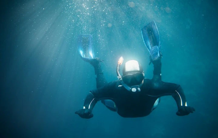
Artificial intelligence enhances the capabilities of robots for improved underwater exploration.

View pictures in App save up to 80% data.

Image source: Unsplash+

The ocean represents one of the final vast frontiers on our planet, encompassing over 70% of its surface while still being mostly uncharted. Autonomous underwater vehicles (AUVs) are revolutionizing exploration by delving into the depths without the need for human operators.

These autonomous underwater vehicles (AUVs) are employed for tasks such as mapping the ocean floor, investigating marine ecosystems, and even locating shipwrecks or valuable minerals. With advancements in artificial intelligence (AI), these robotic submarines are evolving to become increasingly intelligent and proficient.

AUVs function in demanding conditions where direct human oversight is often unfeasible. The ocean is expansive, dimly lit, and rife with unpredictable currents. Conventional AUVs depended on preset commands, limiting their ability to adjust to unforeseen circumstances.

Artificial intelligence is transforming this field by enabling autonomous underwater vehicles (AUVs) to independently make decisions, adapt, and react to their surroundings in real time.

An intriguing advancement has emerged from MIT researchers, who have developed AI systems for Autonomous Underwater Vehicles (AUVs) that leverage machine learning to assess their environments and modify their operational objectives accordingly.

For instance, an AUV used for mapping coral reefs is now capable of identifying significant areas, like thriving or compromised coral, allowing it to concentrate its data collection efforts in those locations. This approach optimizes both time and energy, resulting in more valuable insights.

AI enhances navigation capabilities significantly. When it comes to underwater environments, GPS is ineffective as satellite signals cannot reach through water. To determine their location, Autonomous Underwater Vehicles (AUVs) rely on various sensors, including sonar and cameras.

Artificial intelligence aids in analyzing this data to produce precise representations of the ocean floor. In a particular research project, a group of scientists employed AI to instruct autonomous underwater vehicles (AUVs) on how to navigate around obstacles such as rocks and submerged structures, enabling them to safely investigate more intricate environments.

A significant advancement has been made in swarm intelligence, which involves multiple AUVs collaborating as a cohesive unit. Drawing inspiration from the behavior of fish schools, scientists are creating AI algorithms that enable these AUV groups to synchronize their actions autonomously, without the need for human oversight.

These swarms have the capability to efficiently cover extensive regions, making them ideal for tasks like detecting oil spills or overseeing marine ecosystems. An illustrative case is the European Union's initiative known as “SwarmDiver,” which showcased how compact and lightweight autonomous underwater vehicles (AUVs) can collaborate to monitor underwater pollution levels or fluctuations in water temperature.

AI is enhancing the way we collect and analyze data. Underwater ecosystems generate vast quantities of information, including video recordings and chemical assessments. Conducting a manual analysis of this data can require several months.

Thanks to AI, Autonomous Underwater Vehicles (AUVs) can analyze data in real-time, allowing them to detect significant patterns or irregularities. This capability is especially beneficial in fields such as underwater archaeology, where AI aids in discovering artifacts or shipwrecks through the examination of sonar imagery.

In marine science, autonomous underwater vehicles (AUVs) equipped with artificial intelligence are assisting scientists in tracking climate change. These advanced robots gather essential data regarding water temperature, salinity, and current patterns, offering vital information on the evolving state of the oceans.

They have also been utilized to monitor fish population migrations, investigate deep-sea hydrothermal vents, and study the behaviors of rare marine species.

Nonetheless, challenges persist. AUVs must function for extended durations without surfacing, leading to ongoing constraints related to battery longevity. Additionally, AI algorithms depend on consistent data to make informed decisions; however, underwater environments—characterized by murky visibility or powerful currents—can disrupt sensor accuracy.

Moreover, keeping in touch with AUVs poses challenges since radio waves do not propagate effectively beneath the water's surface, while acoustic signals tend to have slower transmission rates.

In spite of these challenges, the capabilities of AI-driven AUVs are vast. They are making significant contributions to scientific research while also aiding sectors such as offshore energy and maritime security. For example, AUVs can conduct inspections of underwater pipelines or oversee ports for potential threats, undertaking tasks that would be too perilous or costly for human operators.

Artificial intelligence is revolutionizing our exploration and comprehension of the oceanic realm. These intelligent machines are paving the way for new avenues of discovery, ranging from safeguarding marine environments to uncovering resources hidden in the depths of the sea. As innovation progresses, they might even assist in unraveling some of the ocean's most profound enigmas.

The prospects for underwater exploration are promising, and with artificial intelligence at the forefront, we are nearing the revelation of the mysteries that lie beneath the waves.

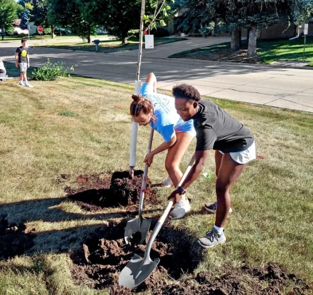
The Unity Earth Science course has launched the Genesis Arboretum.

View pictures in App save up to 80% data. Students Claire Van Voorst and Eve Baart, both in their junior year, are busy digging a hole for a sapling at Unity Christian High School as they work together to establish an arboretum. ORANGE CITY—This fall, Unity Christian High School welcomed 26 new trees to its campus, thanks to the efforts of Kevin Haan’s earth science class, who successfully achieved their dream of creating the Genesis Arboretum. The foundation of the project was established last year. "Haan mentioned that in last year's earth science class, the primary focus was on obtaining permission to initiate a tree planting project, aiming ultimately to establish an arboretum. The students dedicated their efforts to all the preparatory work necessary for this initiative." During the 2023-24 academic year, students in Haan's earth science class explored the numerous advantages of trees, identified suitable planting sites, and showcased the ways in which an arboretum could foster interdisciplinary learning experiences. They compiled their findings into a formal proposal and delivered a 30-minute presentation to Unity Christian's superintendent, director of learning, and head groundskeeper, effectively making their case. “To make a long story short, they agreed and now offer landscaping services along with a wide selection of plants, shrubs, and trees.” As the arboretum initiative started to take shape, it was evident that a name was necessary. Students proposed various options and held a vote to decide. Ultimately, they chose the name Genesis Arboretum, referencing the opening book of the Bible, which describes how “The Lord God made all kinds of trees grow out of the ground — trees that were pleasing to the eye and good for food.” Haan mentioned that the name also embodies his school’s dedication to stewardship and responsible caretaking. "We serve as guardians and caretakers of creation. Our goal is to convey two important ideas to the students: firstly, that this is indeed rooted in science and biology; and secondly, as Christians, we have a responsibility to nurture and protect the environment." Trees play a vital role in an ecosystem, offering shade, serving as habitats for various birds and wildlife, minimizing soil erosion, and enhancing air quality. As the development of Genesis Arboretum progressed, an important task was to choose the tree species that would thrive on the grounds of Unity Christian. “Haan mentioned, ‘The Iowa DNR provided us with a list of native trees suitable for Iowa, as the main goal of this grant is to promote diversity among native species. We aimed to include a wide variety of species, and we managed to acquire nearly one of each type available.’” View pictures in App save up to 80% data. Junior Caleb Altena digs a hole while junior Brody Emmelkamp looks on with a shovel on the grounds of Unity Christian High School. Students in Kevin Haan’s earth science course established an arboretum. Photo submitted The area around the school building features a diverse selection of new trees, including three types of oak, a Kentucky coffee tree, two varieties of honey locust, a birch, and a spruce. Arboreta are classified into four accreditation levels, and Genesis Arboretum holds a Level 1 status. To achieve this level, an arboretum must contain a minimum of 25 species of woody plants, whether they be trees or shrubs, and be located in a site that is accessible to the public. This year, Senior Ava Postma is enrolled in Haan’s earth science class, and her family runs Arden Tree Farms located in Washington state. For the project, Ground Effects obtained some of the trees from her family's business. Postma shared, “My great-great-grandfather was one of the original founders, and this tree farm has been a cherished family-owned business for four generations. I aspire to uphold that legacy and hope to play a role in its future. It's incredible to witness how everything is intertwined.” Haan emphasized species diversity while choosing the trees, partly to fulfill the requirements for achieving Level 1 arboretum status. Nevertheless, his decision was influenced by additional considerations as well. "We aim to avoid the situation we're currently facing with the emerald ash borer," stated Haan. The emerald ash borer is a harmful invasive insect that targets ash trees and has been found in all 99 counties of Iowa. Increasing species diversity within arboretums enhances their ability to withstand diseases or pests that can gradually eliminate a specific type of tree. Take the American chestnut, for instance; it was once a prominent tree species in the eastern United States until a foreign chestnut blight fungus started to proliferate in the early 1900s. As a result, this species is now regarded as functionally extinct. Unity Christian has planted new trees throughout its 10-acre campus located on the western side of Orange City. The decision on where to plant these trees was made in partnership with the school's administration and grounds crew. Care was taken to steer clear of areas designated for athletic teams and potential future construction sites. Haan explained, “These areas may not be practical for the daily operations of Unity, yet they still serve a purpose for biology and ecology. We essentially tried to maximize the available space wherever possible. We added a significant amount of greenery on the east side of the property, adjacent to Michigan Avenue, and also planted several trees along the western edge of the parking lot.” The trees next to the parking area also line a cornfield, and in time, they will form a magnificent canopy over an area that was once overrun with weeds and prone to erosion. Day of Planting On a school morning in late October, Haan's earth science students planted saplings that typically ranged in height from 6 to 8 feet. “We had about 32 children out there, digging holes and relocating trees using the Gators,” Haan remarked. “I teamed up with a representative from Ground Effects, and we focused on spacing and determining the ideal locations for each tree, considering factors like size and soil type. After that, I provided the kids with maps and instructed them, ‘Now it's time to place the trees where they belong; let’s start digging those holes.’” A representative from the DNR was present to offer a brief lesson on the advantages of trees and to assist with the planting and mulching process. Esther Eppinga, a junior, and her planting team received detailed guidelines on the appropriate depth and width for the hole designated for the ginkgo tree they were tasked with planting. “It took us thirty minutes to excavate the hole and plant the tree,” Eppinga mentioned. “The hole measured approximately 2½ feet across and was 1 foot deep. For the following weeks, I made sure to water the Royal Raindrops crabapple — we provided it with a bucket of water every other day.” The fall season was surprisingly dry, making the task of watering the newly planted trees a more challenging endeavor than anticipated. Eppinga mentioned, “The toughest aspect of the entire ordeal was when we had to transport 5-pound buckets brimming with water while making an effort to keep our clothes dry.” In addition to enhancing the aesthetic appeal of Unity Christian’s campus, the trees will also serve as valuable educational resources for Haan’s students. View pictures in App save up to 80% data. Image uploaded. “I have a passion for birds, which is why I plan to have the children monitor bird populations and species annually as we continue to plant trees and allow them to mature,” Haan remarked. “Our goal is to increase both the quantity of birds on our land and the variety of species that visit. Trees provide habitat for countless animals and significantly contribute to the resilience of ecosystems.” This spring, he intends to start monitoring more data points with his students. "Once the weather improves a bit, we plan to begin measuring the diameter and circumference of the trees. We'll track these measurements annually to understand growth rates and how they correlate with climate changes and drier autumns," Haan stated. He will ask his students to investigate the relationships between growth rates and various factors, such as weather patterns. Haan mentioned that he has found it easy to engage his students with the arboretum project. "They've truly embraced it and made it their own," he remarked. A proactive student decided to produce a promotional video aimed at raising awareness in the community about the arboretum project and inspiring donations of trees, possibly in memory of a cherished individual. Additionally, this year's class assigned each student, either alone or in pairs, the responsibility of caring for a specific tree. "We had plenty of trees, so I could easily assign one to each child and say, 'This one's yours to take care of' — it helps them feel a sense of responsibility for that tree." During the autumn season, Postma dedicated her time to nurturing her tree. “My tree is an Aspen Prairie Gold,” Postma mentioned. “During the fall season, I made sure to water it every Monday, Wednesday, and Friday, almost without fail.” Haan expressed his desire to plant additional trees on the school property, despite the fact that the current trees take up a significant portion of the designated space. Senior Abby Van Roekel is relishing the benefits of the project to date, which promises to transform the landscape of Unity Christian’s campus for years to come. “We invested a significant amount of time in research and planning to reach this point,” Van Roekel mentioned. “As this is my final year at Unity, I sincerely hope that the students who study earth science next year will appreciate the joy and beauty of God in the work we've initiated.”

Read more
Mysterious and Unidentified Formations Discovered Beneath the Pacific Ocean

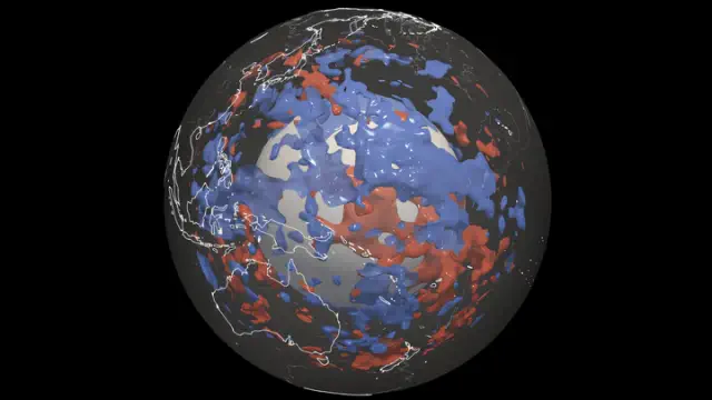
The formations might be new or old, but scientists remain uncertain. View pictures in App save up to 80% data. Here is a representation of the locations of cooler material within the mantle, made possible by an innovative computer model. Image Credit: Sebastian Noe / ETH Zurich. Geoscientists have leveraged earthquake data to investigate the makeup of the lower section of the Earth's mantle beneath the Pacific Ocean, leading to some intriguing findings. They've identified regions where seismic waves exhibit unusual movement patterns, indicating the presence of structures that are either colder or possess a distinct composition compared to the adjacent molten rocks. The researchers characterize these structures as a significant enigma. It is unclear what these structures are. If they were anywhere else, they could be portions of tectonic plates that have sunk in a subduction zone. But the Pacific is one large plate, so there should be no subduction material under it. The researchers are also uncertain about what kind of material these deep structures are made of or what this means for the internal structure of the planet. "That's our dilemma. With the new high-resolution model, we can see such anomalies everywhere in the Earth's mantle. But we don't know exactly what they are or what material is creating the patterns we have uncovered," Thomas Schouten, first author and doctoral student at the Geological Institute of ETH Zurich, said in a statement. The existence of numerous cold areas within the mantle implies that they may have originated at various points in time and from diverse sources. These regions are not solely the result of subduction plates from the past 200 million years. Schouten elaborated, "We believe that the irregularities in the lower mantle stem from multiple sources. They might be remnants of silica-dense substances that have existed since the mantle's formation around 4 billion years ago, managing to endure the convective shifts within the mantle. Alternatively, these anomalies could represent areas where iron-laden rocks have gathered due to the mantle's movements over the span of billions of years." Further efforts are required. The team relies solely on one characteristic of seismic waves—their speed—to deduce a great deal about the processes occurring beneath our surface. Despite having impressive models, it remains a challenge to derive all necessary information from this single aspect. We cannot physically access the Earth's interior to observe its contents.   "Schouten explained, 'We need to assess the various material parameters that could account for the observed velocities of the different wave types. In essence, we must investigate the material characteristics that influence wave speed more thoroughly.'" A paper describing these findings is published in the journal Scientific Reports.

Read more
A Discovery of Hundreds of Dinosaur Footprints Dating Back 166 Million Years Has Been Made in England

View pictures in App save up to 80% data. Pawel Pajor - stock.adobe.com - for illustrative use only During the previous summer, an employee at a limestone quarry located in southeast England was excavating clay when he observed some unusual protrusions in the vicinity. Recently, a collaborative effort involving more than 100 researchers from the Universities of Birmingham and Oxford has confirmed that the bumps discovered are indeed dinosaur tracks, dating back approximately 166 million years to the Middle Jurassic era. Approximately 200 footprints have been uncovered across five distinct trails at Dewars Farm Quarry in Oxfordshire. This recent discovery sheds light on the behaviors of dinosaurs, offering valuable information regarding their speed, size, locomotion, and social interactions. “According to our speed estimates, it is likely that all dinosaurs were more inclined to walk than to run,” stated Kirsty Edgar, a micropaleontology professor at the University of Birmingham. Edgar suggests that the habitat of the dinosaurs may have been similar to the modern-day Florida Keys. Scientists uncovered five trackways preserved in the mud, with the longest measuring nearly 500 feet. Four of the trackways were created by long-necked herbivorous sauropods, probably belonging to the 60-foot, two-ton species known as Cetiosaurus. The fifth set was created by a meat-eating Megalosaurus, a predator that stretched 30 feet in length and had clawed feet with three toes. In 1824, it was William Buckland, a geologist from Oxford, who became the first to scientifically name the Megalosaurus, marking a significant moment in paleontology. In one section of the site, the tracks of carnivores and herbivores intersected, prompting inquiries into the nature of their interactions and whether they coexisted in the same environment. “Researchers have had knowledge of and have been investigating Megalosaurus longer than any other dinosaur species on the planet. However, recent findings demonstrate that there remains untapped evidence regarding these creatures, just waiting to be uncovered,” stated Emma Nicholls, a vertebrate paleontologist at the Oxford Museum of Natural History. View pictures in App save up to 80% data. Pawel Pajor – stock.adobe.com – for illustrative purposes only. The tracks left by the Megalosaurus measured approximately 25 inches in length, with a stride spanning about 8.8 feet. Researchers believe that this dinosaur moved at a speed of approximately three miles per hour, which is comparable to the typical walking speed of an adult human. It is also suggested that the sauropods may have traveled at a similar rate. Dinosaur footprints were initially found in the region in 1997 when workers at a limestone quarry stumbled upon over 40 sets of tracks. Some of these trackways extended nearly 600 feet long. The UK government has identified the Oxfordshire location as one of the globe's key dinosaur track sites, granting it the status of a Site of Special Scientific Interest. In general, the recent findings have shed light on the types of dinosaurs that roamed the U.K. during the Middle Jurassic era. Thanks to advancements in modern technology, prints can now be captured with unprecedented detail, enhancing the importance of the region. In the most recent excavation, over 20,000 images of 200 dinosaur footprints were taken. These images will be valuable resources for ongoing research and educational purposes related to dinosaurs. More About:News

Read more
Researchers express alarm over elements causing extraordinary shifts along the Arctic coastline: 'This research serves as a crucial alert'

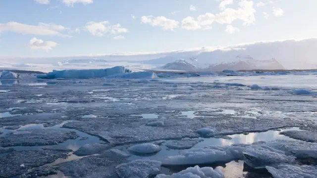
View pictures in App save up to 80% data. Image Courtesy: iStock A recent study conducted in Alaska reveals that the state's coastal erosion is speeding up due to "compound climate impacts." This phenomenon could potentially affect six to eight times more land compared to the effects of erosion by itself. What’s going on? The rising temperatures of our planet are causing swift transformations in the coastal areas of the Arctic. Following a thorough examination of 75 years of aerial and satellite data, researchers have identified a growing threat of coastal erosion in the Arctic region. Other less-understood processes are threatening Arctic coastlines that haven't received the same amount of attention. These "compound climate impacts" include rising sea levels, permafrost thaws, intensifying storms, and sea ice thinning. Inhabitants of northern Alaska have observed the effects of permafrost thaw subsidence, which refers to the sinking of the land surface caused by the melting of permanently frozen ground, commonly referred to as permafrost. Certain scientists express worry that organizations like the U.S. Army Corps of Engineers and the Federal Emergency Management Agency may not be seeing the full scope of the situation. "These sorts of bodies with a lot of resources may have not been paying enough attention to permafrost thaw subsidence as an agent of coastal change," according to Roger Creel, the study's lead author and postdoctoral scholar in Woods Hole Oceanographic Institution's Department of Physical Oceanography, per Phys.org. "This study is a wake-up call to expand the conversation.  "Creel noted, 'The combined effects of climate change are speeding up alterations along the coast. We should anticipate a nonlinear increase in coastal impacts, particularly in areas such as Northern Alaska.'" The acceleration of coastal erosion in Alaska is concerning for several reasons. Firstly, it threatens local communities and infrastructure, as many towns and villages are situated along the coast and are at risk of being washed away. Secondly, the erosion can lead to the loss of habitat for wildlife, disrupting local ecosystems and biodiversity. Additionally, the erosion can contribute to the release of greenhouse gases trapped in permafrost, exacerbating climate change. Lastly, the cultural significance of these coastal areas for Indigenous populations is at stake, as they rely on the land for their way of life and cultural practices. Overall, the rapid erosion poses significant environmental, social, and economic challenges that require urgent attention. "By 2100, unless coasts respond differently to future change, these compound effects may transform 6-8x more land than erosion alone may impact," according to the study. "Without mitigating measures, by 2100, coastal change could damage 40 to 65% of infrastructure in present-day ACP coastal villages and 10 to 20% of oilfield infrastructure." Scientists have concentrated their efforts on the Arctic Coastal Plain in Alaska, an extensive area exceeding 23,000 square miles characterized by low-lying, ice-laden permafrost. This region is currently facing some of the most rapid sea-level rise and coastal erosion observed in the Arctic. 🗣️ In your opinion, does the United States face an issue with plastic waste? 🗳️ Select your option to view the results and share your thoughts! The researchers behind the study emphasize the critical necessity for Arctic communities to engage in adaptive planning, given the challenges presented by escalating climate-related risks. The researchers caution that by the year 2100, the synergistic effects of coastal erosion along with various climate-related factors could drive the North Slope shoreline further inland than it has been since the last interglacial phase, which occurred over 100,000 years ago. Our overheating planet is hitting Alaska hard. A recent report highlights how our 49th state is being impacted by melting glaciers and extreme weather. One of the alarming findings from the study points out that flooding in Juneau last year was caused by glacial melt due to our planet overheating with minimal influence from weather conditions. What measures are being taken to address the effects of compounded climate challenges? The study's authors call for more research on Arctic shoreline evolution in the future, which should be driven by communities affected by the "paradigm shift in 21st-century Arctic coastal change that we project here." Soaring fuel costs are forcing utilities in Alaska to shift to renewable energy sources. Renewable options such as solar and wind will help reduce the amount of heat-trapping gases in our atmosphere that contribute to the problems in our country's biggest state. View pictures in App save up to 80% data. Join our free newsletter for good news and useful tips, and don't miss this cool list of easy ways to help yourself while helping the planet. Awesome Selections

Read more