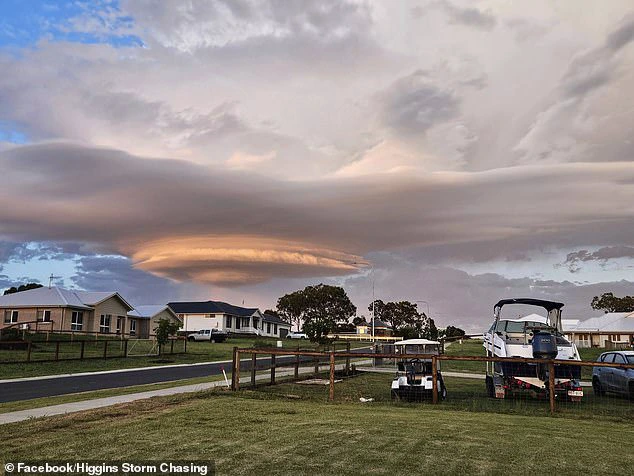
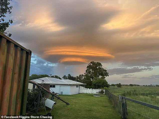
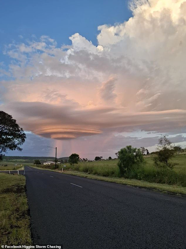
Australians have looked at the skies around southeast Queensland with awe after a giant UFO appeared in the sky.
In reality, it was a storm cell, yet the visuals reveal its strange form that strikingly resembles a UFO.
'We received several pics of this really cool UFO looking storm this morning. This is a lenticular storm cloud and its not that common to see,' Higgins Storm Chasing wrote to their Facebook page on Thursday morning.
The weather page explained the cloud formation was a hailstorm that was moving across the Darling Downs towards Oakey and north of Toowoomba around sunrise with the light from the early morning sun 'helping ignite the eastern side of the storm, turning it pink and orange'.
Viewers who commented on the post expressed that the event was an extraordinary showcase of nature's beauty, noting that "the sky always manages to astonish us."
"Look, you can see the 'Beam me up, Scotty' beams," one of them remarked.
"Wow! I really appreciate you sharing this storm cell; it's absolutely breathtaking," exclaimed another.
'Who needs drones and aliens when you can have this in the sky,' added a third.
View pictures in App save up to 80% data.
View pictures in App save up to 80% data.
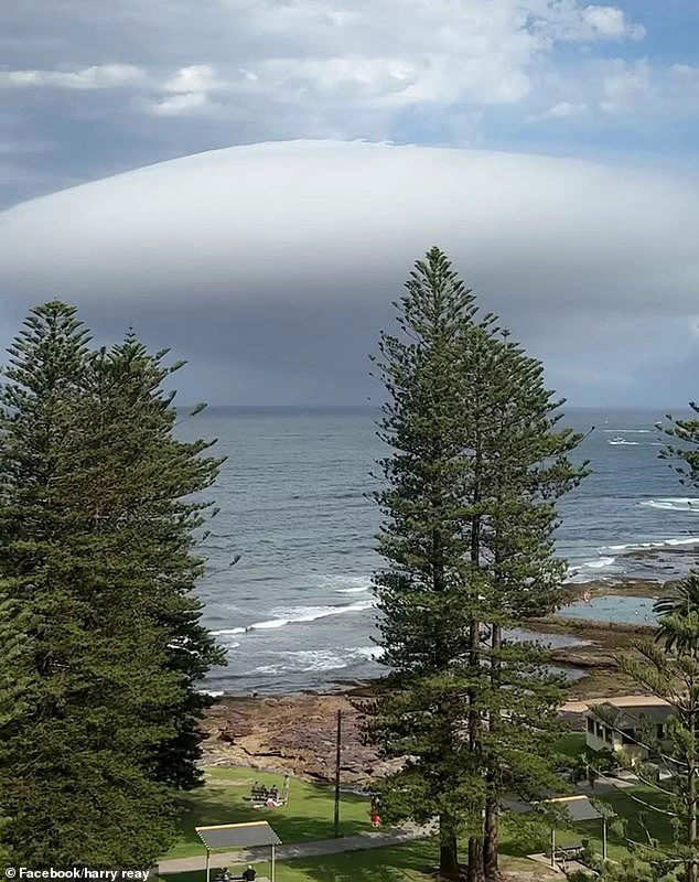
The spectacular display follows a similar 'spaceship' cloud appearing in Sydney.
The bizarre natural phenomenon formed over the ocean in Cronulla, in Sydney's southern suburbs, with many sharing snaps and videos of the cloud to social media.
However, Weatherzone meteorologist Felix Levesque reassured Daily Mail Australia that the unusual cloud posed no cause for concern.
Some speculated that the 'spaceship' was actually a lenticular cloud, a phenomenon described by the forecaster as occurring when humid winds are pushed over an obstacle like a mountain.
Mr. Levesque explained, "As the air moves upward over the barrier, it cools and condenses, forming a stationary cloud."
'This stationary cloud will have a smooth oval appearance, hence why it's often mistaken as a UFO.'
Mr. Levesque explained that the cloud observed over Cronulla was actually a roll cloud, distinguishing it from the lenticular cloud, which is formed through a similar mechanism.
"Roll clouds develop when a cooler, heavier airmass moves underneath a different airmass, which results in an upward and 'rolling' motion at the forefront of the airmass – thus the term," he elaborated.
View pictures in App save up to 80% data.
View pictures in App save up to 80% data.
'Southerly busters, similar to what we experienced on Tuesday, can lead to the formation of roll clouds, which typically happen in Sydney around three to five times annually.'
'A common location for roll clouds is over the Gulf of Carpentaria – so common it's been given the name 'Morning Glory Cloud'', Mr Levesque said.